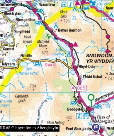
Even in the 1860s the evidence for this section of Roman road was rapidly disappearing. I rely on Jenkins’ account to look for remaining evidence, most importantly three bridges of some antiquity, and have also identified a possible alignment in Waunfawr as an alternative to the A4085, which is considered by OS to be a Roman road. For references see bibliography.
M’s description, which is based on the very brief description by W. J. Hemp Y Cymmrodor vol33 p171, is of a road approximating to the A4085 from Caernarfon through the Gwyrfai valley and then W of Beddgelert to Aberglaslyn, then the 1795 coach road through Croesor and across to Tan Y Bwlch, and so on to Tomen y Mur. Since Margary’s day, a direct route from Segontium to Traeth Mawr RRX95 has been identified to serve the Roman fort discovered at Pen y Llystyn GAT144. In current terminology RRX95 can be seen as a military “A” road, and RR68 as a “B” road, more direct but of later design with few alignments once it gets into the hills.
There are historical references to this route which show it has been used for centuries linking Caernarfon to Beddgelert, whose Priory certainly existed before 1282, and was probably much older than that. For instance Pont Peblig (ie a predecessor of the present modern bridge) features in a petition (see below) in 1651 (GAS XQS/1651/129) and a “crime report” in 1652 (GAS XQS1652/66). A version first appears in mapping in 1795 although it was not one of the the first turnpike trusts in the county. Instead early improvements such as the new skew bridge at Rhyd Ddu SH56945295 GAS XPlans B/153 3/10 & 2/11/1778. were carried out as a result of a process of “presentment” or petition to Quarter Sessions for improving a county road, in which a number of petitioners applied for roads or bridges to be improved by the county surveyor, the cost being charged back to the parishes through which they ran. This procedure appears regularly in the surviving Quarter Sessions records, Many of these earlier bridge references are very brief, but by the C18th the procedure was sufficiently routine for “pro formas” to be made out in advance, with the details of bridge and highway added in a different hand. By later in the century we have detailed specifications for stone bridges laid out in contracts, most of the main bridges on the A4085 appearing in the 1770s (GAS Xplans B/143, 147, 150, 157, 170, 214), which were generally widened from nine to eighteen feet, which they remain to this day – rather narrow by modern standards – and made more flood resistant. Although the contractors provided warranties, apparently they were not always effective because problems recur in later entries. In July 1796 (GAS XD2/13096) a list of subscribers, led by local gentry and contributing some £270, is set up “towards the cost of widening and repairing the public highway from the town of Caernarfon to Pont Aberglaslyn, so as to be fit for all kinds of carriages, and to open a free communication between the counties of Caernarvon and Merioneth”. By 1802 Williams can say p43 “the road which is now well improved as far as Aberglaslyn bridge” (although not to everyone’s taste it seems, H p220, referring to Beddgelert, “much amendment in the choice of a level may I think be easily had along the road coming from Bettws” – unless this is is an out of date reference going back to before 1778. It was taken over by the Old Caernarvonshire turnpike trust as a result of the Act of 1810 (50 Geo III c52). Nonetheless it seems a petition to Quarter Sessions could take place even after a trust was established, eg with reference to the bridge at Beddgelert in 1814 (GAS XQS/1814/141) and elsewhere in the county (GAS XQS1795/93, XQS/1815/119 & 123).
1795 is the first reasonably detailed map of North Wales, although it does not reach the same standard of surveying as subsequent OS maps. It shows the present main road as a coach road much as now until Rhyd Ddu. As noted above, the bridge there was built in 1778 – which shows that the mapping of 1795 can be out of date, since the coach road it shows does not utilize it, instead it runs to the west of Llyn y Gader roughly on or near the line of the subsequent tramway, now a cycle route, eventually returning to the modern road just beyond Pont Glan y Gors, which is shown although not named. The turnpike development via Rhyd Ddu and Pitts Head means this route was abandoned by the time of the OS 2in to the mile drawings of 1818.
M and modern OS regard the present A4085 from Segontium to Waunfawr as Roman because it is in straight lengths as far as Waunfawr. The first part which actually passes through the fort of Segontium, appears on 1818 as it is now, save that it had a clear downstream zigzag at the crossing of Afon Seiont at Pont Peblig, a variation which has now disappeared under industrial building. However 1795 shows what appears to be an “unimproved” course at Caeathro, and again approaching Pont Crymant (ie the modern Waunfawr), which leads me to conclude that the present course is the result of a late C18th improvement survey across what was at the time common land. The fact that a now fairly straight modern road runs out of Segontium in the desired direction does not make it a Roman road, beware the turnpike!
However there is field evidence for a different aligned route running from Plas Glan yr Afon, SH50405980, which is of C17th origin (GAS 12153). through to Waunfawr. Possible routes NW of this point to Segontium are not clear, but this location is very close to the northward projection of RRX95 identified by Hopewell as GAT36427, so it may simply have joined it hereabouts, eg at SH49826018. Part of this alignment is now Lon Gwyrfai, and publicity boards assert this is “along lanes and tracks that date back to the time of the Romans”. Just before the Plas, which is now part of a riding establishment, a side stream comes from the NE at SH50355984, at which point the track has curved N to maintain a level course to cross it. There is clear evidence of a more direct route going straight across the small valley on the alignment, followed by a field boundary on 1891, andwith a footbridge at SH50305986, but this is not now accessible. Beyond the farmyard it becomes a straight level tarmac lane, maintaining an aligned course just above the main river valley, to a crossroads at SH50825970, where it was formerly met by a now derelict footpath that could represent another Roman route (see Llanberis to Segontium). The whole of the cycle path is now a tarmacked road which then turns N just before Caemabynyr SH51385961, to meet the A4085. OS mark a right of way (Waunfawr 35) past the house, and going straight on across the fields. In reality it is completely inaccessible. This whole area has become Snowdonia riding stables, a major tourist attraction, with yards, paddocks, CCTV, and polite questions asked of anyone who doesn’t seem to fit. I got thrown off a panicking pony here nearly 50 years ago. As elsewhere in Gwynedd in my experience, little used rights of way simply get eliminated, and the Council has neither the resources nor perhaps the inclination to resist “development”. Further on the map shows a field boundary, and just S of the lane to Fron Goediog at SH51825950 there may be some slight evidence of a roadway with edging stones. This then closes with another lane, to which there is no access, but after a slight change in alignment there is a field boundary marked continuing the line at SH52115938 towards Waunfawr. All this section of the route stays on the brow immediately above the small gorge to the S in which the Gwryfai runs, strongly suggesting a surveyed route. All features appear on 1891. This whole section is better aligned than the A4085 labelled Roman by OS.
South from Waunfawr we need to refer to Jenkins’ account p143, which disregards the coach road and A4085 completely. His book is dated 1899, although he says much of it is translated from an address given by a William Jones at an eisteddfod in Beddgelert in 1860. See https://biography.wales/article/s-JENK-ERW-1864 . It has recently been republished and should be fairly widely available.
“Several portions of the well-known road which connected Segontium (by Carnarvon) and IS (near Trawsfynydd) can still be seen in this valley. It ran from Carnarvon through Waen Fawr, and then south by river Gwyrfai, on its eastern side, as far as Melin y Rydd in the vale of Bettws Garmon, where it crossed over to the other side of the river. It then passed right underneath Castell Cidwm, climbed up Gallt y Llyn (the slope above Cawellyn), where it can still be seen, and passed west of Llyn Y Gader by the hill called Y Gadair, to Glan y Gors. We see nothing of it again until we pass Meillionen, and then it is seen above Ty’n y Coed, whence it can be followed in a field of Cwm Cloch. It can scarcely be doubted though now obliterated that it made straight for the front of the place where now stands the Royal Goat Hotel. From here it followed the same course as the present road, until near the old engine-house — now used as a hay shed — on the right-hand side of the road. It then crossed over Bryn y Felin, passing through a cutting in the rock by a little tower, and crossing over the very mouth of an old copper level, to emerge once more into the main road, about ten yards south of the third telegraph post from the old stamping houses on the roadside. We know nothing definite of its course again until we are right in the Pass. Some think that parts of it can be traced on the rocks above the road. A part of the embankment approaching the old bridge of the pass is still visible. About a dozen or eighteen slender fir-trees grow on it, drawing their moisture from the impatient stream that hurries by. Some five yards beyond the Aberglaslyn Bridge, on the Nanmor side, we see an old cutting above the road, on our left, which marks out its further course ; and here we shall leave it at present”.
In 1845 Bransby p52 also described “vestiges of a Roman road called Ffordd Pawl…the celebrated road which passed by the edge of Cwellyn Lake”.
Following this description, we find at SH52535925 the alignment already described is picked up by a narrow lane shown on 1818 diverging from the main road and continuing on the NE side of the valley, whereas the present main road crosses the river and runs parallel to it on the SW. 1891 records a milestone at this junction “Treflan 4” although it is in fact one mile. It is no longer in evidence.

From Waunfawr the next 3km of the Gwyfrai runs in a wide marshy valley, very possibly a filled in glacial lake, which this lane avoids, albeit by negotiating a number of side streams, and climbing through a windgap to the E of Garreg Fawr SH537584. There is a RoW branching W from it at SH53505863 and going down and round the lower W side of Garreg Fawr, but there are no field traces that it might ever have been a road. At SH53715388 the lane has a gate indicating no public access. There are mediaeval sites here, GAT refs 4203, 5078, 7321. A farmhouse dated to 1544 was removed and rebuilt at the St Fagan’s folk museum in Cardiff in the 1970s. Beyond the farm buildings SH53785821 the track now turns a right angle over a small stream. However 1818 possibly continues the road going under what are now slate tips back to the A4085 by the church of St Garmon. It’s one of the several places where this particular drawing has unfortunately become quite damaged over the years, when I asked to see it at the British Library thirty years I was told it was too fragile to be brought out for viewing, so we have to manage as best we can with the digital image now available online. Lidar image now available seems to support this route.
The track turning right, which the occupants of Treflan are anxious to tell you is not a right of way, turns sharply to the E and is well constructed as might be expected for a mine working, and eventually splits into several versions approaching the ironstone mine known variously as Silurian, Ystrad or Betws Garmon SH542577 (GAT 20549), which has been worked like a copper mine on a lode of ore in the Nant Ffrancon series of mudstones, creating a long gash right up the hillside, very striking on the ground but barely detectable on the maps. I have tried several times to find evidence along the mining track and going back down to the valley without success. The whole area is now very overgrown and difficult to navigate, and the paths are effectively derelict..
At first sight this route from Waunfawr to Melin y Rhydd seems improbable. In comparison with the present main road, it seems rather a detour, the route has climbed some way above the valley only to come down to river level again but on the positive side it avoids a large expanse of flat marshy ground below, which must have been a lake at some time in the past. And a route must have existed by 1544 to provide access to Treflan .
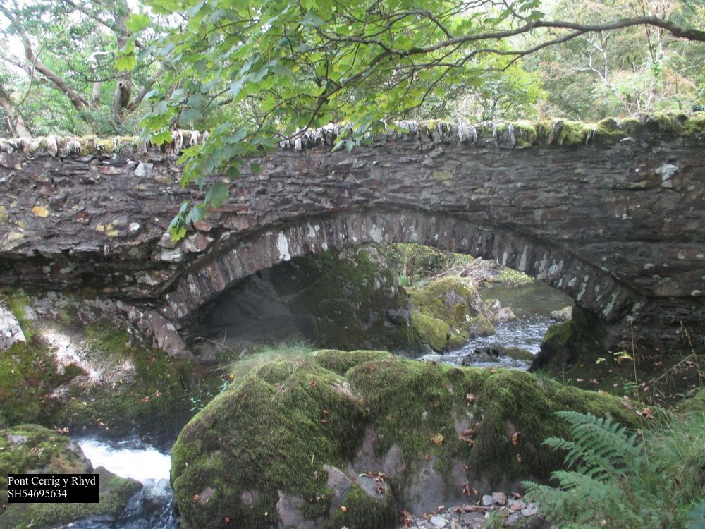
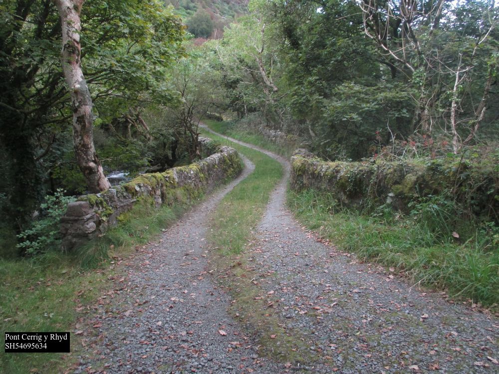
Beyond Betws Garmon church, it must have followed the A4085 or something very similar, in the main Gwyrfai valley now runs SE as a narrow trough exiting from Llyn Cwellyn, with a “pinch point” between crags at SH547563, the Melin y Rhydd of Jenkins’ description, “where it crossed over to the other side of the river”. There is indeed a bridge here, Pont Cerrig y Rhyd GAT63274, Grade II listed, 3m wide, which is shown on the undated engraving of the now demolished Nant Mill (GAT 6492) GAS XS/3092/2. The mill is marked, but not the bridge, in 1795 and 1818. This substantial bridge is quite unnecessary for the modern access to a couple of houses and a footpath,
The RoW following the track turns (little used) W at SH54595628 up the cwm into the mountains. Currently (April 2023) it is closed on account of fallen trees. The track, prominently signed as “private no access”, continues S to Cwm Bychan farm SH54585600, where it ends. There is nothing now beyond that in the fields until Castell Cidwm is reached. M doubts the possibility of this because he seems to think there is no room between lake and mountain at the northern end, but this is not the case, there is a terrace/RoW on this side, which could answer to it. OS maps show the current water level of the lake, now a reservoir, to be three feet higher than in the nineteenth century.
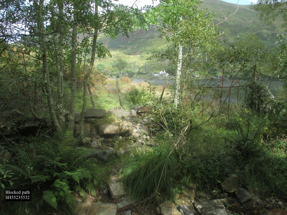
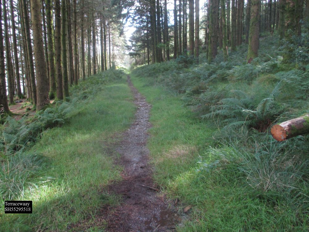
In its present form the northern end of that track is blocked at Castell Cidwm slate quarry SH552552 (GAT 20185) by a barbed wire fence extending in the lake to deter walkers going any further, but 1891 shows a track curving past the end of the lake (and therefore over Afon Gwyrfai) to the main road. To the S the footpath of 1891, (but the southern end a road in 1838) which was in open moorland at the time, is still evident and at SH55295518 appears on a shallow terraceway 5m wide, which corresponds to Bransby’s description.
It is soon overlaid by a modern forestry road running to the end of the lake, but where it drops down to the camp site at the S end of the lake SH56575408 a slightly hollow lane can be found along the wood edge continuing the alignment to a ruined building SH56735382 and out into an overgrown meadow where traces of a terraceway continue at SH56775376, most clearly observable from the main road below. Beyond another ruined building a stone pillar for a gatepost at SH57025342 would mark the same line, then the waste from Cwellyn slate quarry precludes any further evidence. This line would bring an older road back to the 1795 coach road at the T-junction just above Rhyd Ddu bridge SH5695296. In view of Jenkins’ description below, it could be regarded as a later variation of the Roman route, eliminating the climb to Bwlch y Moch.
However Jenkins already quoted states the Roman road “climbed up Gallt y Llyn”, which implies we should be looking at a higher route now represented by the bridleway Bettws y Garmon no. 38 shown on modern maps climbing to Bwlch y Moch, there is a now very degraded path roughly corresponding to this line crossing the steep slope as a terraceway. It is obstructed by fallen trees, but still sometimes used by walkers from the camp site. It will become quite impassable in a few years time. This route does not appear on any OS maps at all until RoW information is added in 1971. The definitive map, as is regularly the case in England and Wales, does mark out a slightly different route from this course, but there is no evidence for that on the ground. The last few metres of the track has been obstructed by fallen trees until the exit from the forest is reached at SH56135400, where a wicket gate (recent replaced with a “kissing” gate)

originally allowed passage through the stone wall. Crossways there is another RoW coming up from Planwydd by the camp site SH56795397, used by modern walkers to access Craig y Bera SH543542, which in 1891 came through the same gate, 1795 shows this route as a road running down into the Nantlle valley, ie the predecessor to the 1810 turnpike/modern B4418, and this is generally recognized now as an east-west packhorse trail. The western section is now part of the Snowdonia Slate Trail. See my article on Bwlch Rhediad.
Bwlch y Moch gives a good view of much of the surrounding country; in addition to Jenkins’ comments, the route is more direct when 1795 is seen as the southward continuation rather than A4085, and it gives easy access to Drws y Coed copper mines if they were active (possible but unproven) when it was devised. The hypothesis that this could be the original course seems therefore to be a reasonable one, but the lack of any confirmatory field evidence is frustrating. If correct, again we have a road that chooses high ground, not valley bottom, as its preferred route.
Beyond the pass the bridleway is mapped coming to an abrupt end close to the shore of Llyn y Dywarchen, but it does not appear on 1891 and it cannot now be traced on the ground, except for a vague path created by modern walkers to get down to the lake. 1891 does show a footpath going slightly E of S, through the now abandoned farm of Llyn y forwyn past the E end of Lyn y Dywarchen. This lake was famous even in John Leland’s day for having a floating island. It’s size grew considerably when it was converted into a reservoir for Drws y Coed copper mine in the nineteenth century. The 1891 path came down to the present road at SH56275290. No trace of this path now remains in the peaty ground and the S end of it is steep and awkward. However, later OS 6” surveys show an alternative path a little to the E, and this is reflected by gates in the walls at SH56415277 and again at an oblique angle to the present B road at SH56415278. The southward continuation from the latter point was in 1891 the only access to the house now called Drws y Coed Uchaf SH56475269 GAT83656 and such a route would give a connection straight into the 1795 route described below. It has only been during the C20th that the farm name migrated to this site, originally it belonged to the building by the dam on the B road at SH55905332, where the name makes better sense as a pair to Drws y Coed Isaf in the Nantlle valley
————————————————————————————————————————
From Rhyd Ddu the A4085 is as now from 1818 on, straight to the top of the shallow pass at Pitt’s Head, with the Welsh Highland Railway taking the same course first on E and then to W. For the origin of the name Pitt’s Head see Jenkins p152 – it does not refer to the top of the pass. The modern A4085 crosses Afon Colwyn by Pont Caer Gors, SH57585091, but 1818, 1838 and 1891 show a by road leaving here and running on the W side of the river parallel with the present main road. This is still technically a public road leading down to a car park, and then a drivable track running down past Hafod Ruffydd Isaf to its own crossing of the Colwyn at Pont Hafod Ryffydd or Pont Glan y Gors (1891) SH5749495, rejoining the main road as a tarmac lane a little further down. The main road is a slightly longer and gentler ascent, and does not appear on 1818, demonstrating that it is a “turnpike mk2” and the by road “turnpike mk1”, just like the A498 coming up to Pen y Gwryd from the S. This is confirmed GAS Xplans/B153, which is a contract with the Quarter Sessions clerk dated 3rd October 1778 to build “a new bridge over Afon y Gader at Y Rhyd Ddu [see above] on the new road leading from Quellyn bridge to Pont ar Golwyn”. The latter must be what 1891 calls “Pont Hafod Ryffydd or Pont Glan y Gors”, since 1818 shows the only other bridge over the Colwyn, Pont Caer Gors, did not exist at the time. The 1778 contract for Golwyn, GAS Xplans/B143, is to repair the existing bridge, not make a new one, and similarly for Quellyn GAS Xplans/B150, showing that the other parts of the present road antedate the modernization. A Pont ar Golwyn, which must be the same, is referred to in 1660 (GAS XQS/1640/M2).
The 1795 coach road shows a more circuitous winding course going W of Llyn y Gader. This is about ¾ mile longer than the present road, nonetheless the mileage figures from Caernarfon on some editions of 1795 are located at the current turnpike milestones, ie they reflect the shorter route not the longer one, presumably because the survey was done prior to 1778 and the mileages added later. The original route coincides with Jenkins p143 “[Roman road] passed west of Llyn y Gadair, over the hill called Y Gadair, to Glan y Gors.” Just above the bridge the B4418 (itself turnpiked around 1810) branches from the A4085, then at SH56685263 the modern road turns sharp right, and 1891 records a “tablet” at this point with mileages to Llanfihangel and Dolbenmaen – this refers to the “bridlepath” that goes on up the hillside, through what is now forest, and ultimately into Cwm Pennant by way of Bwlch y Ddwy Elor (“dark and magnificent passage” H p232, GAT 9648-9659). This pass is generally regarded as an “old” route although there is no evidence of construction going up the hill on this side, it is a footpath rather than a proper bridleway, and is currently in quite a dangerous condition. It does appear to be the route described by GAS XQS/1735/41 & 42 “the bridge of pont Llanfihangel on the road between pwllhely and Llanrwst was in 1726 presented by the Grand Jury at the Quarter Sessions to be ruinous and out of repair”, and mentioned even earlier GAS XQS/1657/184 and XQS/1658/E/22. Since 1891 the tablet has been moved and is now set into the roadside wall back at the road junction in Rhyd Ddu, it is carved out of cut slate and is of the same type as those at Aberglaslyn bridge, and elsewhere. It is listed, GAT63276.
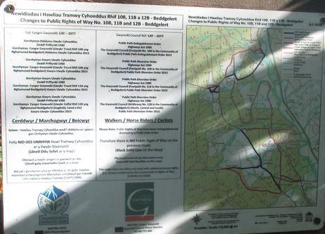
The following section covers a right of way which was closed in 2013 and superseded by the creation of the Lon Gwrfai trail Rhyd Ddu to Beddgelert.

From SH56685263 this bridleway continues the line of the road as a modest causeway (road on 1838 as far as the stream) going straight on from the junction across gently falling ground to a small stream at SH56455246, which it now crosses by a vehicle-width platform of old railway sleepers, then climbing the hillside as a footpath. Nb hut circles at SH56235214 GAT597 “Roman”. Our line is nominally represented on modern OS by another bridleway (which cannot be found on the ground, and has now been deregistered) almost at right angles crossing a little further up the hill to the W. Presumably this is the route referred to by Bransby p52 “on the S side of Drws y Coed may be distinctly seen the traces of a still more ancient road, Mignedd, which forms a passage…to Cwm Marchnad”; and probably the same one marked on 1795 as connecting at Drws y Coed with the packhorse trail from Bwlch y Moch already referred, by ascending gently to the present B road at Bwlchgylfin. However it is not shown on 1818/1838/1891 and there are no obvious traces on the very marshy ground. 1891 shows a footpath starting from the head of the quarry tramway across the marsh by the lake, falling in with the modern RoW beyond Gader Wyllt at SH56475185, the second of the two small quarries. However, there are traces of two other routes across this ground, the first through a galvanized iron gate at SH56425237, from which a terraceway can be traced leading up to the first quarry Llyn y gader – this presumably was the access to it before the tramway was built further E. The second less distinct route is represented by a blocked Victorian era wicket gate at SH56355237, then a galvanized iron gate at SH56345224 followed by more railway sleepers over a stream, and a third set of sleepers across a watercourse at SH56305222. At the next stream there are no bridge remains, but a slight terraceway climbing the S side at SH56325210, followed by slight hollows or terraces at SH56375193, SH56425188, etc., although there has probably been some disruption hereabouts from slate waste tipping. A modern ladder stile at SH56425178 is the first evidence of the actual map RoW, then a terrace SH56445178 climbs away from the stream, apparently forming an upstream zigzag to get over the watercourse before turning S at SH56485180 on the line of a stone wall. This whole area is a shallow peaty hillside with impervious slate near the surface, and little or no boulder clay to soak up any water, hence the many streams.
The stone wall now runs almost due S for several hundred metres, with evidence of a road variously underneath or to one side or the other, evidently laid out using the road as a guide but after it had gone out of use. At SH56525178 there is a prominent sinuous hollow way – presumably the 1795 coach road – up to 2m deep on the E side of the wall which eases the climb up the hill, with a much slighter hollow immediately under the wall itself. A terraceway can be seen at SH56545167 forming the leg of another upstream zigzag to a watercourse which has had the peat removed to improve drainage, and in the bottom at a depth of about 1m there are clear traces of metalling

The opposite leg is a slight hollow SH56545164, 1891 clearly showing this zigzag as the course of the footpath. More peaty ground follows with no distinguishing features. At SH56555144 the path passes into Beddgelert Forest. This is one of the older forestry commission sites, and much of this area has been ploughed, cleared, and in places allowed to regrow naturally, so that other than the access roads it is often impenetrable, and any field evidence undetectable; Our path seems to run in the bottom of a shallow hollow way until it joins a forestry road, SH56535127, waypoint 47 in the Natural Resources Wales pamphlet of Beddgelert Forest walks. Walking in the opposite direction this path can be located immediately by the waypoint.
I have recently revisited this route. The land over which it runs, which is open access land, has been abandoned, and apart from the wall and the hollow way of the 1795 “coach road” it has degraded into a morass of rushes and peat bog over which it is almost impossible to make any progress. All the other features I noted have disappeared. At waypoint 47 I discovered the closure notice of 2013, a large nonbiodegradable plastic panel, abandoned in the undergrowth, and retrieved it.
The forestry road is the modernized version of one shown on 1838, in which it appears to be an access road coming down from the old level and small quarry on Bwlch Ddwy Elor GAT9648, which was by the packhorse trail to Cwm Pennant referred to earlier. From waypoint 47 the forestry track continues the alignment of the old road SE to waypoint 63, SH56975079, where 1838 turns E to reach the main road at Pont Caer Gors. This whole section from Rhyd Ddu would have gone out of use once the turnpike was finished in 1778, and high rainfall and peat have rapidly obscured the original course.
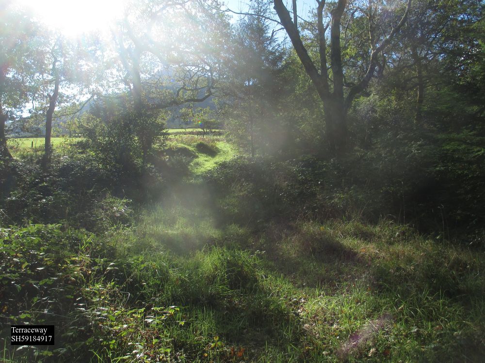
Picking up from waypoint 63, on 1891 there is a footpath/wall (just wall 1838) continuing the alignment from waypoint 63 and then curving more southerly to reach Glan y Gors at SH57315013, a site now lost near the present forest car park at SH57355026. This whole section is now completely impenetrable forestry regrowth. There is a little used modern path from the car park down to the bridge, with some suggestion of a hollow way in the undergrowth immediately to the west, more obvious now on lidar than on the ground. Hereabouts the 1795 version of the route goes south east to Pont Glas y Gors and rejoins the A4085 to run into Beddgelert.
Jenkins p143 above talks of the Roman road going to this farmhouse, but no trace beyond. However to the west the present access road to Hafod Ruffydd Ganol/Isaf crosses just below the confluence of Afon Hafod Rhuffydd Isaf and Afon Cwm Du, by an arched bridge Pont Rhyd Cefyllau SH57325001 (GAT9674, waypoint 87). The bridge appears on both 1838 and 1891, and on each side there appear to be two intact dry stone abutments, very large fairly regular blocks, capable of taking a timber predecessor.
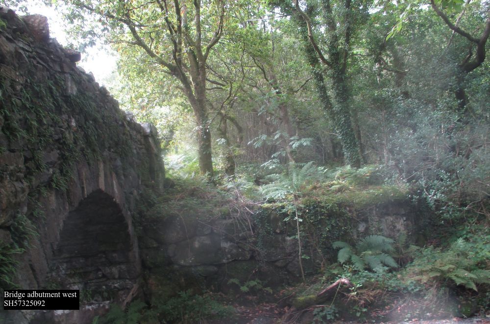
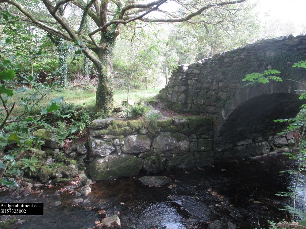
This is unusual and probably significant. The bridge itself now has a 5 ton weight limit. The arch appears to have been originally constructed in dry stone, with some subsequent mortaring. The track proceeding from the bridge is not straight, but skirts marshy looking ground and crosses the hillside below Hafod Ruffydd Isaf. From the bridge onwards it has been upgraded to the new Lon Gwrfai trail, so there are no historic traces until we cross Afon Meillionen ( ie “clover”) by way of a very substantial but unnamed bridge at SH57214919; this resembles Pont Rhyd Cefyllau above in that it was a single arch entirely of dry stone construction some 3m wide, but with no parapets. It appears to have been built within two abutments some 25m apart, again suggesting the possibility of an earlier wooden bridge albeit a rather long span. Like Pont Rhyd Cefyllau it is carefully sited just below a confluence but before the valley becomes significantly incised. Despite its obvious age it’s only reference in GAT is 83819 “unknown footbridge”. and I can find no name for it.


The creation of the new bridleway in 2013 has obscured it’s original features. Beyond the bridge the modern bridleway turns east into the forest to reach the forest campsite and railway station, rejoining our route further south.
West of the bridge a terrace turns to the north
and 1838 & 1891 then mark a path running into and through a double field boundary at SH57394872 through Meillionen farm SH57464881 GAT1953, which like many of the houses in the area is of C16-17th date, when freeholders acquired land following the dissolution of the priory at Beddgelert. This farm is not part of the forest, or on open access land, and now that the footpath through it has been declassified it is completely inaccessible to the public.
All the route from Pont Rhyd Cefyllau to this point is shown on 1838 as an approach to Meillionen itself. Through a stone wall, in which there is now no break or sign of reworking, 1891 then has a path running through Parc Ty’n y Coed as described by Jenkins, now untraceable, to the edge of the forest at a stream SH57754848, when Lon Gywrfai rejoins the route again. The stream is crossed by both a ford with what look likes non modern paving, and a modern footbridge.

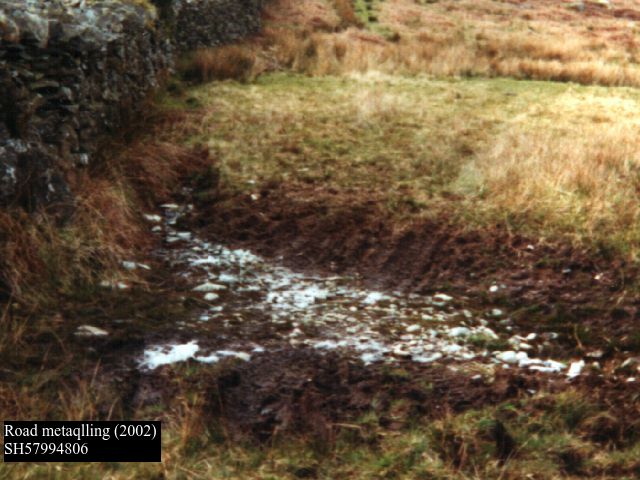
Beyond this the modern bridleway carries on S, and there are several substantial dry stone culverts, which may also not be modern. Some years ago at SH57994806, I observed slightly to the E of the modern route, that water had exposed a metalled surface with a slight terraceway coming down from the N. However, these fields are no longer grazed, and the growth of rushes means that I can longer find it even in midwinter.
This stretch coincides with J’s description p143 above, and additionally at p130 “Mr. Thomas the farmer at Cwm Cloch Uchaf] very kindly took us along a lengthy portion of the old Roman bridle path, which can still be unmistakably traced through three or four of his fields”.
Beyond Cwm Cloch Uchaf farm (which is of C18th origin), there is now a track and public footpath leading to Bron Hebog continuing the line for a while, but in fact neither this nor the house is present on 1891, not appearing until the 1900 edition. So it is not possible to make out any route beyond here, “obliterated” even in Jenkins time. There was an “undefined” footpath marked on OS maps running to SH58544793, now obliterated by a large railway embankment, and I can find no evidence now E of that point in Parc Cae Morys, which like much of Beddgelert is National Trust land. 1838 and 1891 do however show a roadway running from Cwm Cloch down the hill to SH54854819, over a “footbridge” at SH58474818, a modern concrete construction now, and then alongside the railway as a road running past the rear of the Royal Goat hotel to SH58704801. This is substantially out of alignment with the course from Meillionen, this could be because of a change of surveyors, which has been observed elsewhere as an unnecessary reverse curve, or simply that a more direct descent has vanished. Beyond the back of the hotel it is obliterated by the railway (both the current line and an earlier unfinished version) and an abandoned reservoir presumably for the hotel, which was built in 1801. It would pass by the modern cemetery at SH58734777.
The bridleway that crosses it here is of considerable age, appearing on both 1795 and 1818, and is a continuation of the “ancient trackway” running down Nant Gwynant (see separate article). It fell out of use when the turnpike was built in 1801 from Beddgelert to Tremadog, and like many others in Gwynedd cannot actually be used by either a horse or a cyclist, especially at the Gorseddau quarry SH57324519 where it was obliterated by slate tips in the C19th, as I discovered to my cost some years ago.
Our line then falls in with the path which becomes a terraceway running up to the entrance to Bryn y Felin copper mine GAT20527, in accordance with Jenkins p143 SH58964721. The features beyond that, including the remarks at p317 “near the bottom of the hill, between the wall and the river, is a cluster of fir trees … thriving on a small embankment, which projects towards the river at an angle of something like forty five degrees. The embankment is a part of the old Roman road, and it cannot be much more than twenty years since one of the abutments of the bridge was washed away…Just opposite this little grove lay the pool called Llyn yr Hen Bont… which was made possible by the strong weir which existed halfway between the Roman bridge and the present bridge” cannot now be identified.
Aberglaslyn bridge is at SH59424625 (GAT11683) and if you look underneath with some care, you can still see where it was doubled from nine to eighteen feet wide. Feature at Jenkins p310 is still exists “Some five yards beyond the Aberglaslyn Bridge, on the Nanmor side, we see an old cutting above the road, on our left, which marks out its further course.”
The coach road of 1795 passing through Bwlchgwernog, and reckoned by M to be Roman, is anything but straight, but see GAT 1509, 3098, 17541, 34536 for evidence that it could be.
Appendix – Gwynedd archives references to bridges Caernarfon to Beddgelert. In geographical sequence
1652 Pont Peblig XQS1652/66 May 6 DEPOSITION of Thomas Williams of Glan Gwnnis [Glan Gwna], aged about 35, concerning the behaviour of Robert Moore, a Scot or “Scots sonne”. He deposes that his daughter was travelling with Thomas Hughes of Nant whin, gent., Ellen his wife, Rowland David of Traflan, yeoman and Mary his wife, to T.W’s house at Glan Gwnis [Glan Gwna] when they overtook R.M. with Henry Williams, the son of William Williams of Wern, near Peblicke [Peblig] bridge etc.
1785 Pont Peblig XPlans B/214 1785 modifications to Pont Peblig, apparently the 1779 specification resulted in too much of a hump back, resolved by building the road upon each side to the level of the top surface. Other bridges received similar treatment, eg Pontrug GAS XPlans B/151. This is not the modern bridge of the same name, but a now lost predecessor downstream, see 1795 and 1838
1776 Pont yr Cyrnant Waunfawr XPlans B/1701 Oct Pont y Crymant (also 159). Repair bridge. This bridge still carries A4085, and has been reduced to a single lane by traffic management.
1660 Pont Betws Garmon. XQS/1660/117 Jan. 8 PRESENTMENTS of: various bridges for disrepair. Appended: NOTE concerning order for Pont Bettus Garmon.
1776 Pont Betws Garmon XPlans B/157 21/12/1776 Bettws Garmon. Repair bridge. Present A4085
1787 Pont Betws Garmon XQS/1787/147 Oct. 1 PRESENTMENT of the jurors and body of Carnarvon that the bridge Bettws Garmon over the river Gwrfai was in a very bad state of repair and that the inhabitants of co. Carnarvon should amend it. Endorsed: A true bill. Present A4085
1779 Quellyn XPlans B/150 11/9/1779 Quellyn Repair bridge. Present A4085
1778 Rhy Ddu XPlans B/153 3/10 & 2/11/1778. New bridge. Present A4085
1778 Pont Hafod Rhuffydd XPlans B/1432/9/1778 Golwyn. Repair bridge. Must be Pont Glan y Gors on the old turnpike route at SH57494995
1814 Beddgelert XPlans B/186 1802 Re repair of Beddgelert bridge, with accompanying sketch.
1814 Beddgelert XQS/1814/1491814 July 15 INDICTMENT preferred by John Jones against the inhabitants of pa. Beddgelert for not repairing Beddgelert Bridge. Present A498.
John Byde. Revision date 7th May 2024